America’s Red Rock Wilderness, Film Crew
Date: 05/30/2025
State: UT
Issues: Climate, Mining, Off Road Vehicles, Oil and Gas, Watersheds, Wild Lands, Wildlife
Partner: Southern Utah Wilderness Alliance
Airport Origin : Moab, UT
Mission
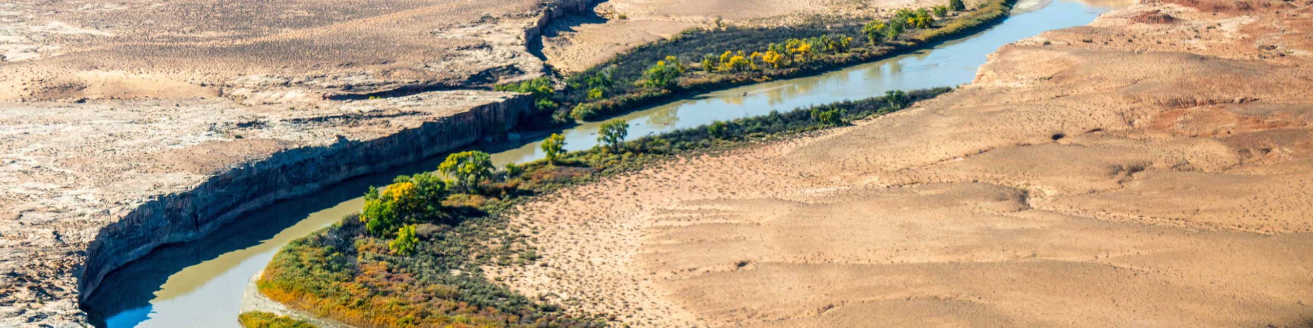
Fly with our partner SUWA, ZDF German TV, and local media over Canyonlands, Bears Ears, Labyrinth Canyon and the surrounding public lands to learn about threats and potential protections!
These lands are currently under attack, as the current administration and numerous local legislators threatens to sell off land for budget reconciliation while shrinking beloved national monuments.
In order to defend against public lands sale, further designations and protections are needed. This landscape is one small piece of the proposed America's Red Rock Wilderness Act (ARRWA) which will conserve vast swaths of desert and create wildlife habitat connectivity across Utah and the greater west. The ARRWA is considered one of the most critical actions we can take to mitigate climate change - these lands and plants store an estimated 247 million metric tons of organic carbon. Preserving those storages, along with the prevention of future oil and gas development, could reduce atmospheric carbon up to 30 million metric tons by the end of the century. From above, it is abundantly clear how worthy this special place is of permanent protection.
The ARRWA is comprised of a patchwork of proposed areas, and throughout its 20+ year history, the patchwork keeps shrinking as successful campaigns preserve pieces of the proposal, a few landscapes at a time. There have been a number of successes, but there are still a number of threats, ranging from public land sale and unsanctioned OHV travel to mining and energy development. The only way to mitigate these threats is to maintain the pace of conservation and continue preserving lands outlined in this bill.
Click for photos from your flight, videos from your flight, geo-referenced photos (download and open in Google Earth), and this collection of aerial Labyrinth Canyon photos.