Date: 03/02/2021 State: CA Issue: National Parks Partners: Audubon Society, Mojave Desert Land Trust Airport Origin : Chiriaco Summit, CA
Mission
Fly Senator Feinstein staff with Mojave Desert Land Trust and Audubon Society to give elected officials a better understanding of a proposed new national monument and expanded federal wilderness designations in Riverside County, and create a virtual tour video to educate and inspire the public to become involved in the effort.
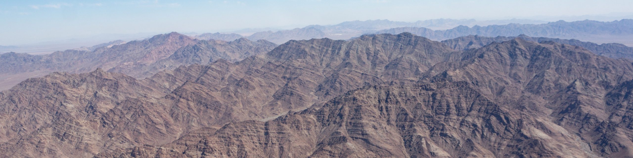
The Chuckwalla area is important corridor that links wildlife habitat between National Parks, Monuments and other protected areas with other parts of the Mojave Desert. Without permanent protection, the rare and special status flora and fauna here risk becoming confined to isolated islands, and unable to move and adapt to threats like fire and climate change. This area next to Joshua Tree National Park contains resources of national significance. For example, the Chuckwalla ACEC has the highest density of desert tortoise, up to 200 individuals per square mile, the greatest numbers of wintering birds, a unique subspecies of mule deer, and the highest plant diversity in the Colorado Desert, 158 species. The area has also been determined to be the best location for the re-introduction of pronghorn. The area is also rich in cultural resources including ancient trade routes, the historic Bradshaw Trail, established in 1862, and world class rock art sites.
Almost the entire region that you'll be viewing (south of I-10 from the eastern border of the Mecca Hills Wilderness to the western border of the Mule Mountains) is critical habitat for the threatened desert tortoise.
Conservationists proposed to greatly expand the Chuckwalla Mountains Wilderness in 2006. Back then, Representative Mary Bono Mack only agreed to a much smaller expansion because she didn’t want to block potential solar development. As a result, in both 1994 and 2009 mostly the mountains were protected while the vast “bajadas” (the great flat lands that come down from the mountains and sweep north towards I-10) were left unprotected.
Flight Images
Zenfolio returned an error: 50014: There is no such photoset.
Zenfolio returned an error: 50014: There is no such photoset.